Stage 3 (26/09) - Badajoz / Badajoz
SS4
P1 - Don Benito (Spain)
38° 57.169'N - 5° 50.942'O
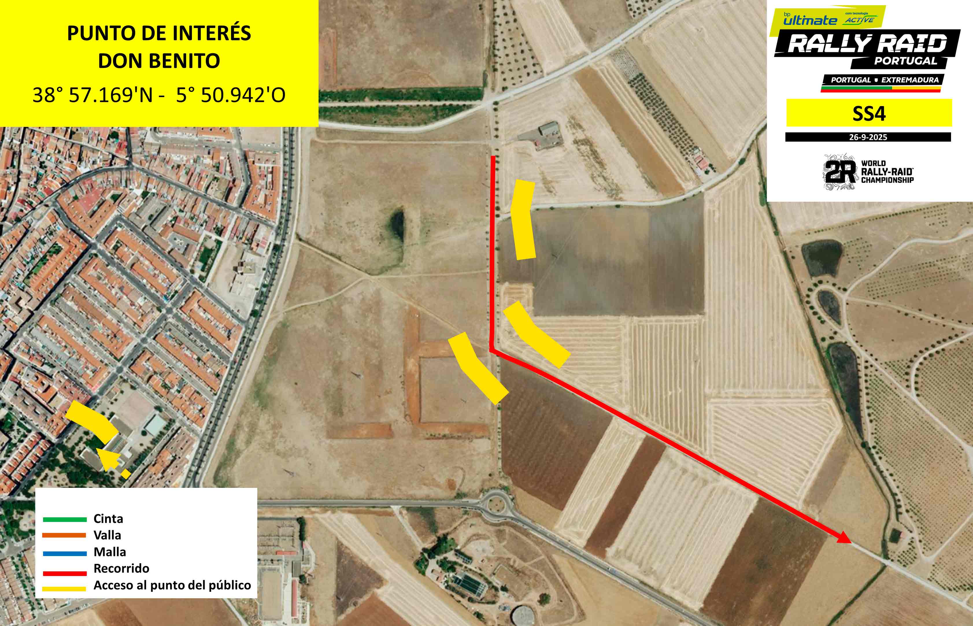
Location: In Don Benito, next to Avenida de Córdoba - km 0
Features: Highly visible exit, where you can see the first bends
How to get there: Google Maps
Access: Access via Avenida de Córdoba in Don Benito. Street parking is advised.
Schedule:
1st Bike - 8h35am (Portuguese Time)
1st Car - 10h45am(Portuguese Time)
P2 - La Haba (Spain)
38° 55.197'N - 5° 48.250'O
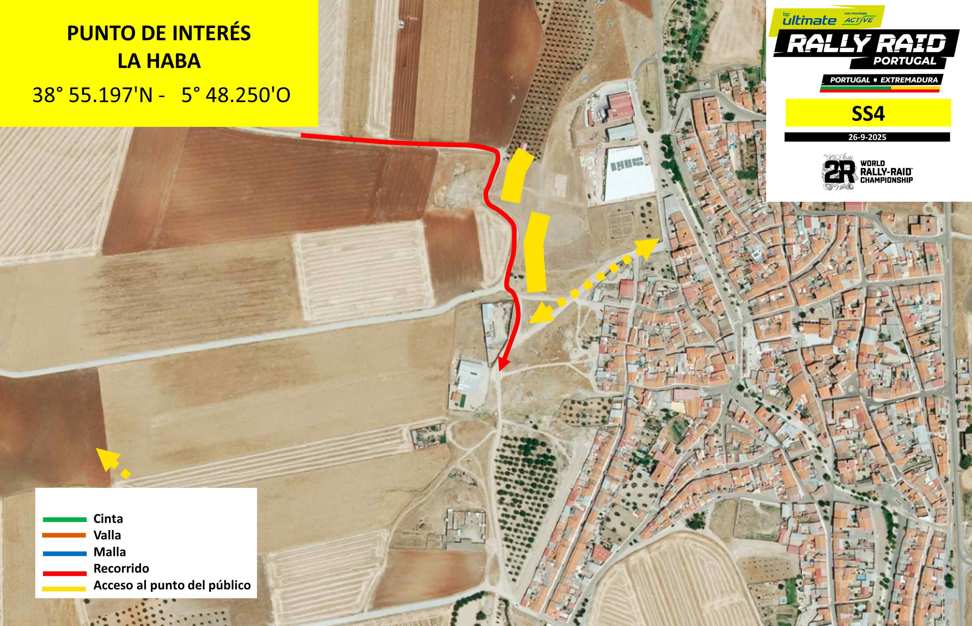
Location: In La Haba, next to Cuestra street - km 6
Features: Spectatular area with several consecutive curves next to the town of La Haba
How to get there: Google Maps
Access: Access via Cuesta Street, in La Haba
Schedule:
1st Bike - 8h40am (Portuguese Time)
1st Car - 10h50am (Portuguese Time)
P3 - Manchita (Spain)
38° 48.706'N - 6° 0.874'O
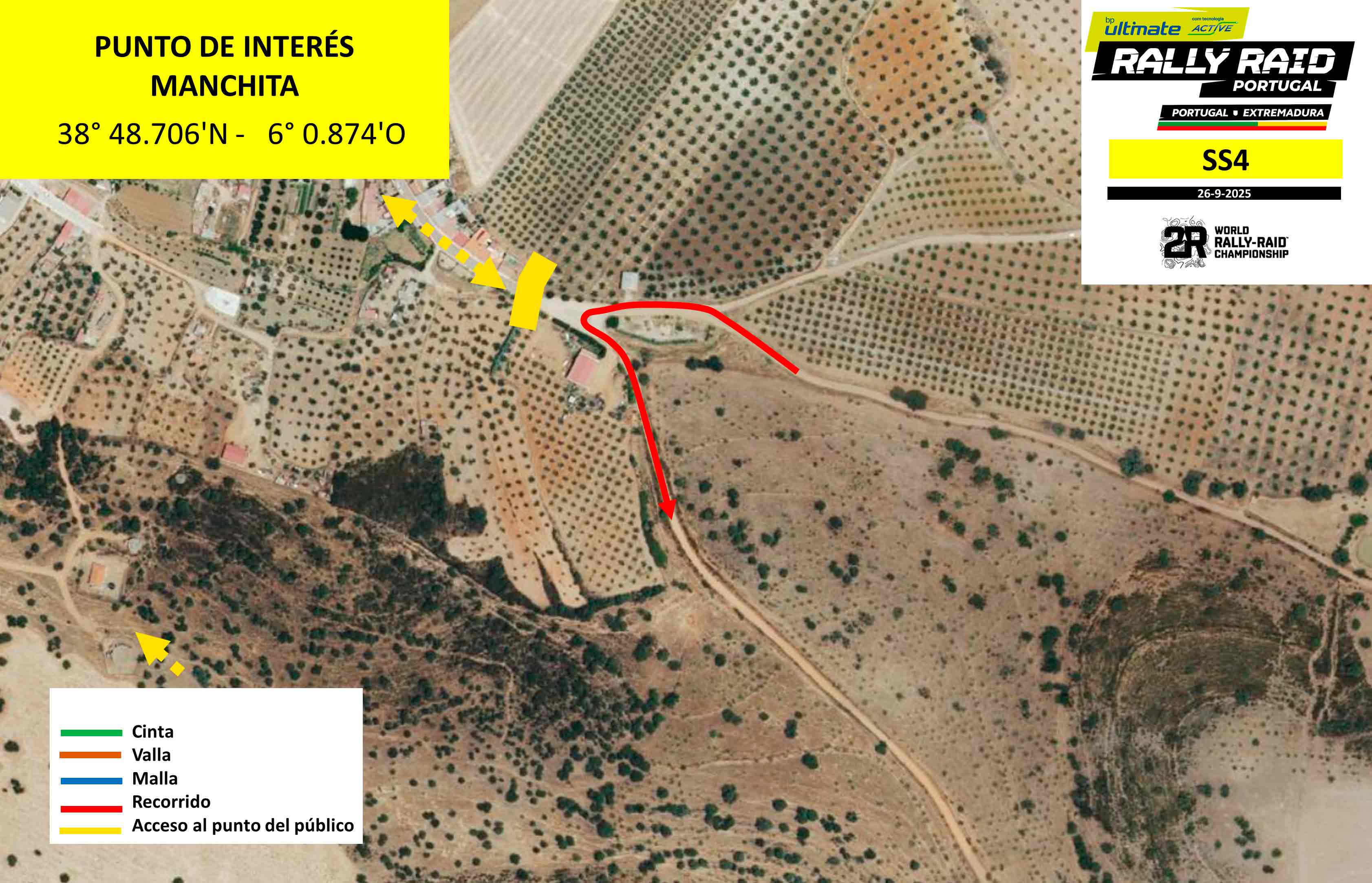
Location: In Manchita, next to Parque Del Tejar - km 160
Features: Harpin next to the town of Manchita, in Parque del Tejar
How to get there: Google Maps
Access: Access to Manchita and Parque del Tejar. Parking in the town is advised
Schedule:
1st Bike - 10h05am (Portuguese Time)
1st Car - 12h05pm (Portuguese Time)
P4 - Cristina (Spain)
38° 50.038'N - 6° 5.759'O
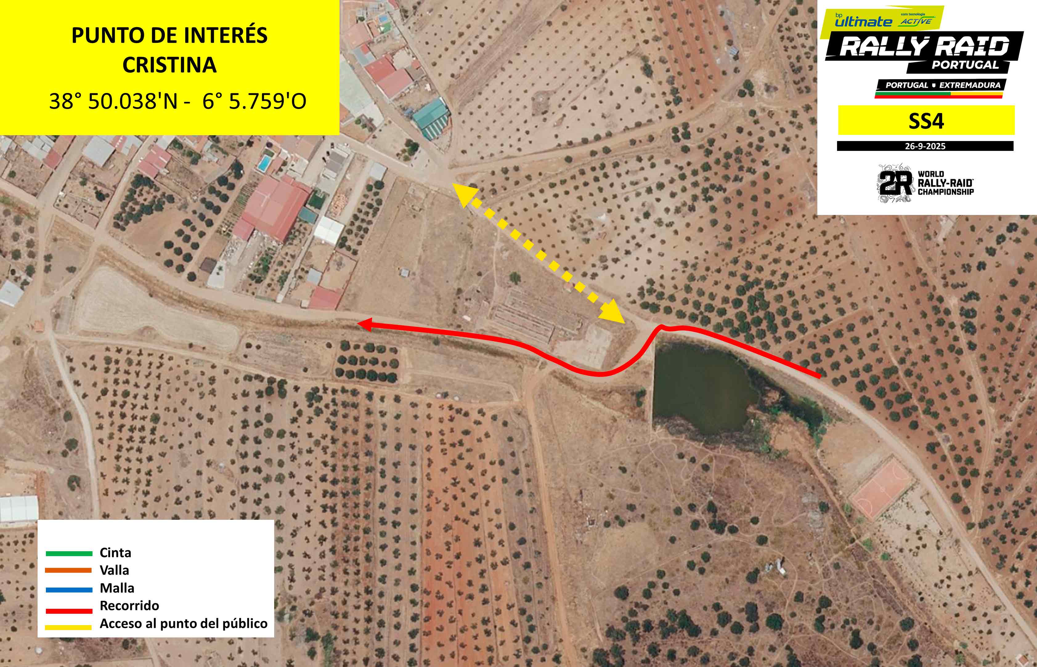
Location: In Cristina, next to the lake - km 176
Features: A series of bends next to the village. It comes from a fast area next to an abandoned factory
How to get there: Google Maps
Access: You can access Cristina next to Príncipe Filipe Square, where you should park your vehicle
Schedule:
1st Bike - 10h25am (Portuguese Time)
1st Car - 12h30pm (Portuguese Time)
P5 - La Zarza (Spain)
38° 49.146'N - 6° 11.824'O
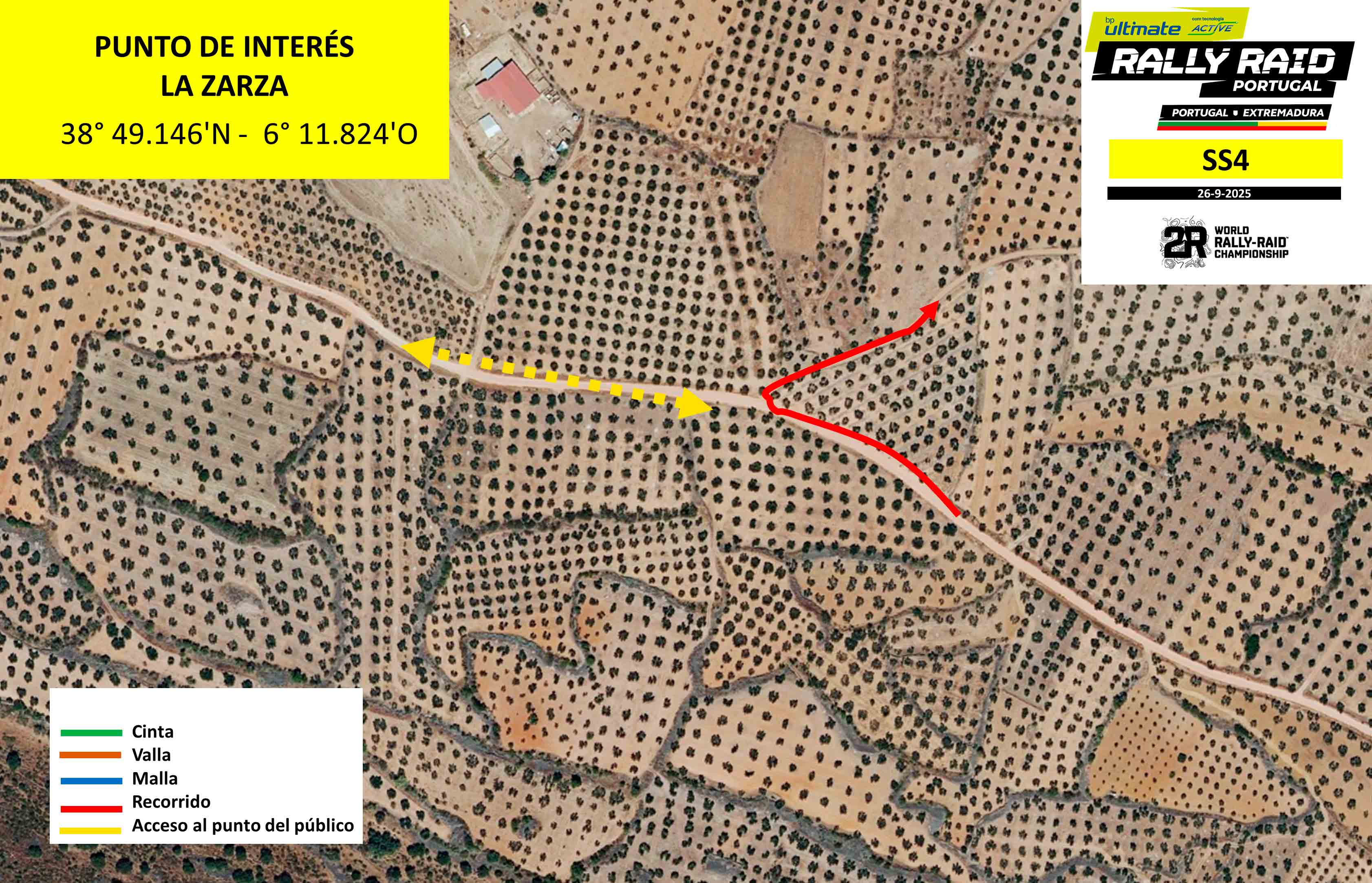
Location: On the outskirts of La Zarza - km 190
Features: It comes from a fast section that ends in a very tight right-hand bend, which in turn leads to an olive grove
How to get there: Google Maps
Access: Access from La Zarza on the track to Oliva de Mérida
Schedule:
1st Bike - 10h35am (Portuguese Time)
1st Car - 12h35pm (Portuguese Time)
P6 - Palomas (Spain)
38° 41.611'N - 6° 7.628'O
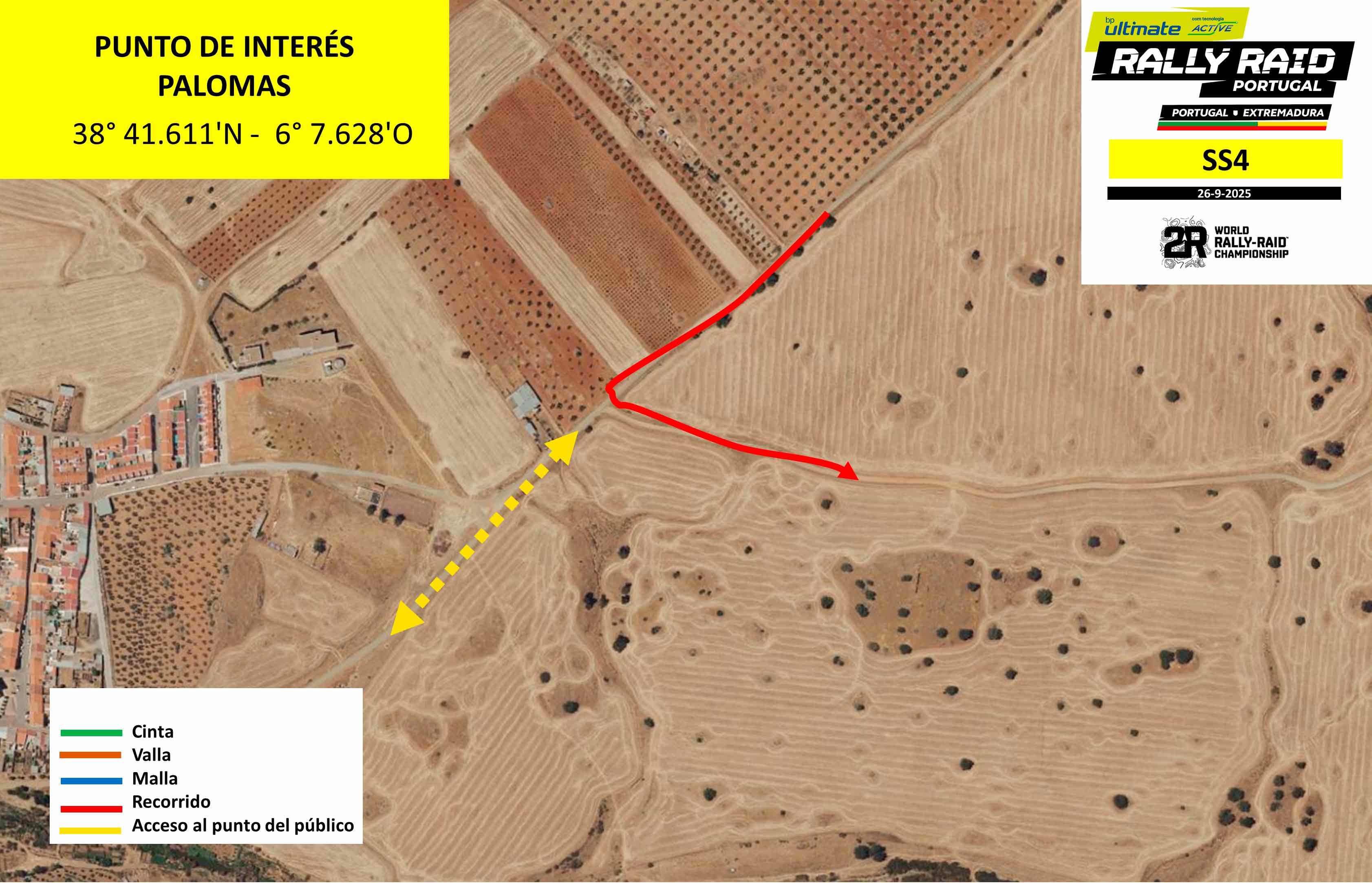
Location: In Palomas, at a nearby crossroads - km 237
Features: Sharp bend near the town of Palomas, which continues onto a fast road
How to get there: Google Maps
Access: Access from the town of Palomas via the street behind the church. Parking in the town is recommended.
Schedule:
1st Bike - 11h05am (Portuguese Time)
1st Car - 1h05pm (Portuguese Time)
P7 - Puebla de la Reina (Spain)
38° 39.382'N - 6° 5.802'O
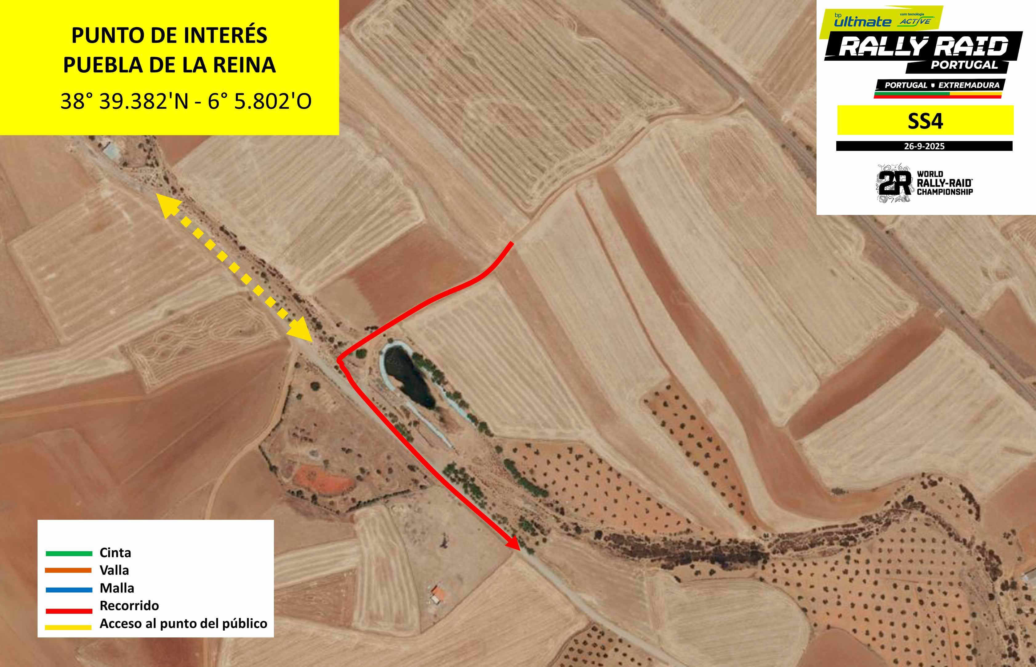
Location: Near Puebla de la Reina, at Merendero Las Herrerias - km 244
Features: Dry passage next to a lake and near a picnic area. The section continues in a fast area
How to get there: Google Maps
Access: Access happens via Calle Ramilla. Parking within the town is recommended
Schedule:
1st Bike - 11h15am (Portuguese Time)
1st Car - 1h15pm (Portuguese Time)
P8 - Hornachos (Spain)
38° 33.661'N - 6° 4.675'O
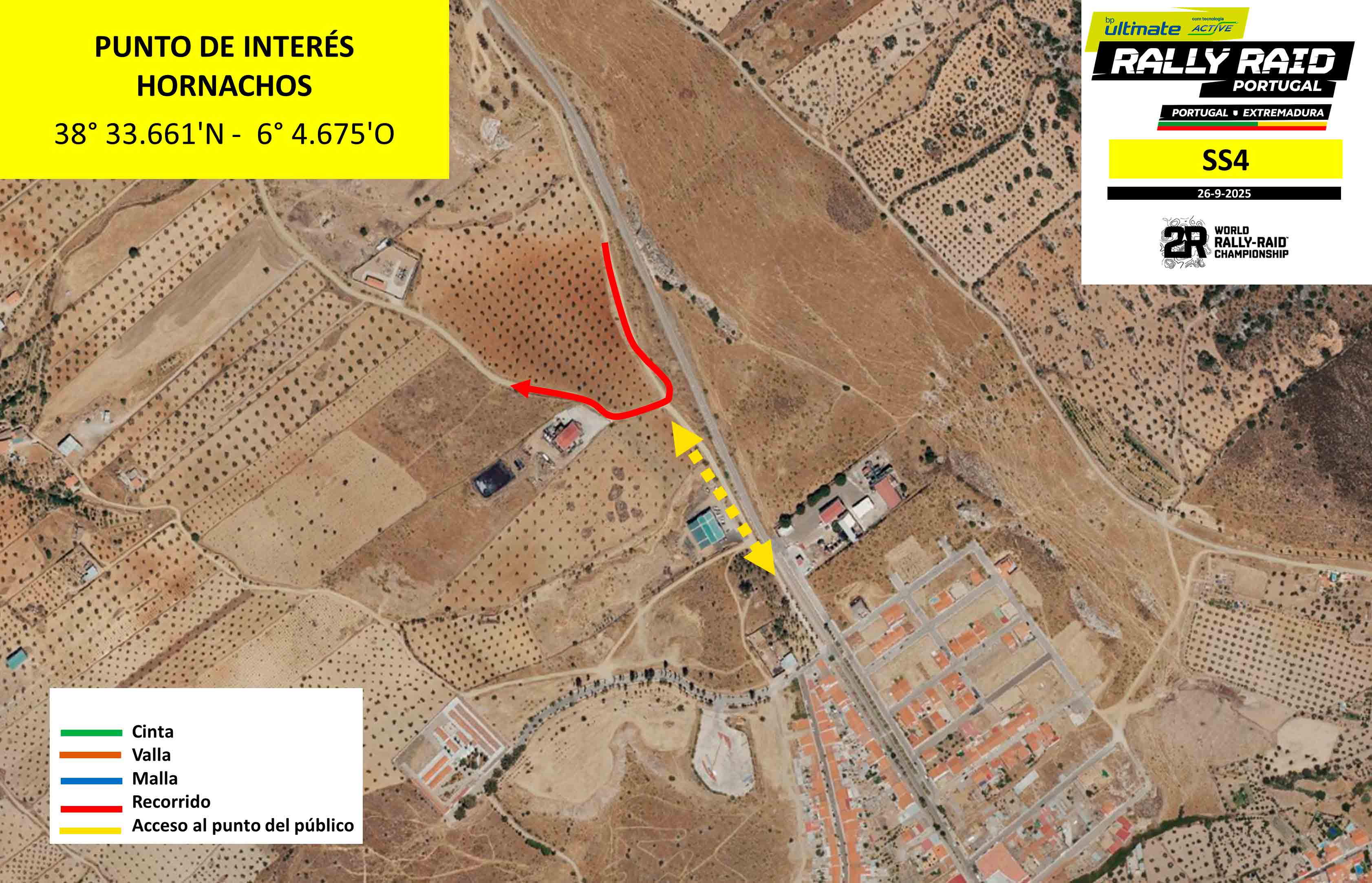
Location: Hornachos road parallel to the EX-344 - km 259
Features: Road parallel to Hornachos with Puebla de la Reina, ending in a slow corner near the town. Before and after the curve, there is a fast zone
How to get there: Google Maps
Access: Acces is via Hornachos road to Puebla de la Reina. It is recommended to park in the town of Hornachos
Schedule:
1st Bike - 11h25am (Portuguese Time)
1st Car - 1h25pm (Portuguese Time)
P9 - Villafranca de los Barros (Spain)
38° 34.070'N - 6° 20.796'O
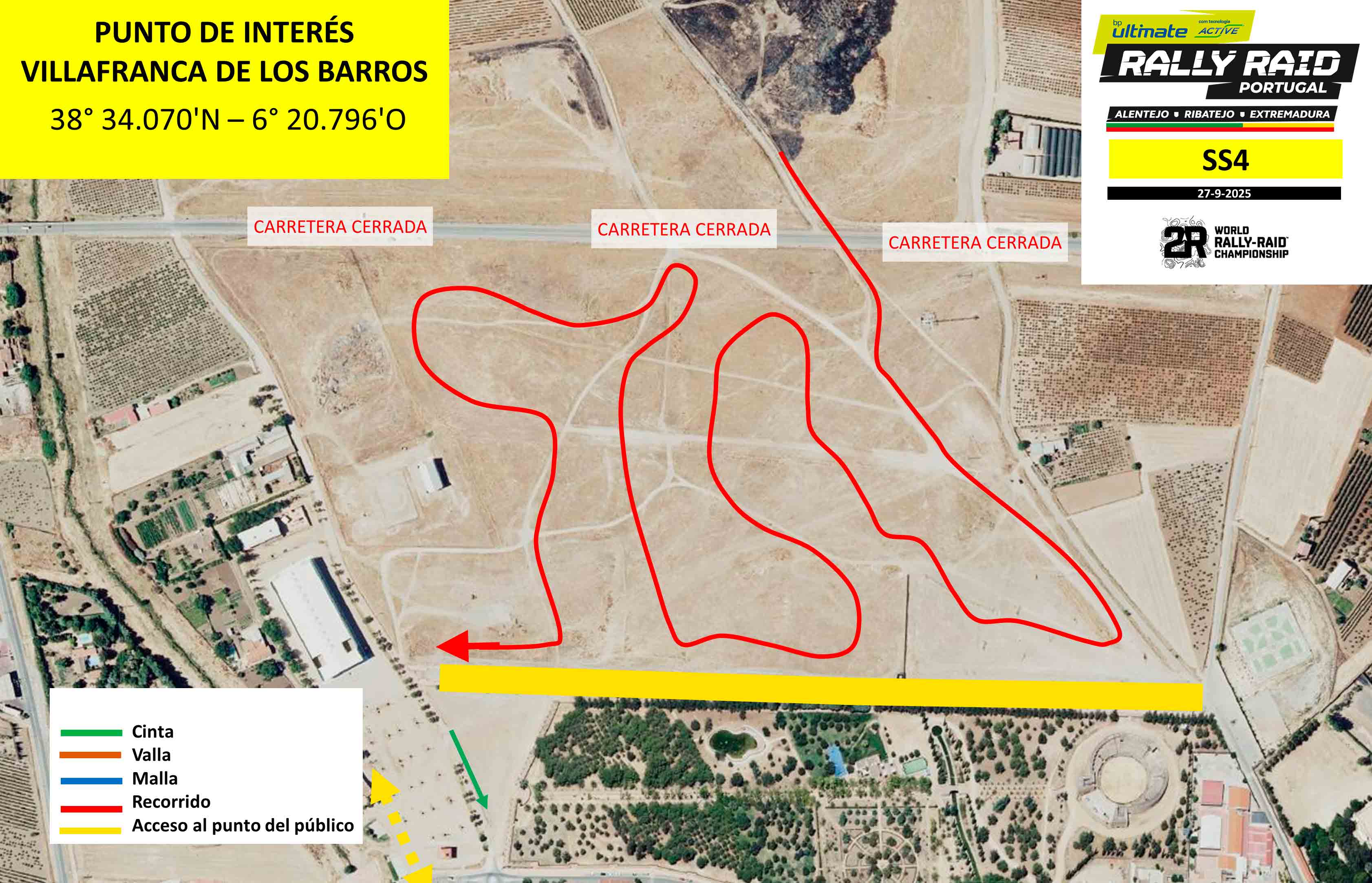
Location: La Silera de Villafranca de los Barros - km 308
Features: 3-kilometre circuit on the outskirts of the town of Villafranca de los Barros, where the finish line is located
How to get there: Google Maps
Access: Access is via Avenida de Almendralejo. Parking is available at the fairgrounds
Schedule:
1st Bike - 12h00pm (Portuguese Time)
1st Car - 2h00pm (Portuguese Time)