Stage 2 (25/09) - Grândola / Badajoz
SS3
P1 - Couço / Coruche
39° 0.257'N - 8° 17.515'W
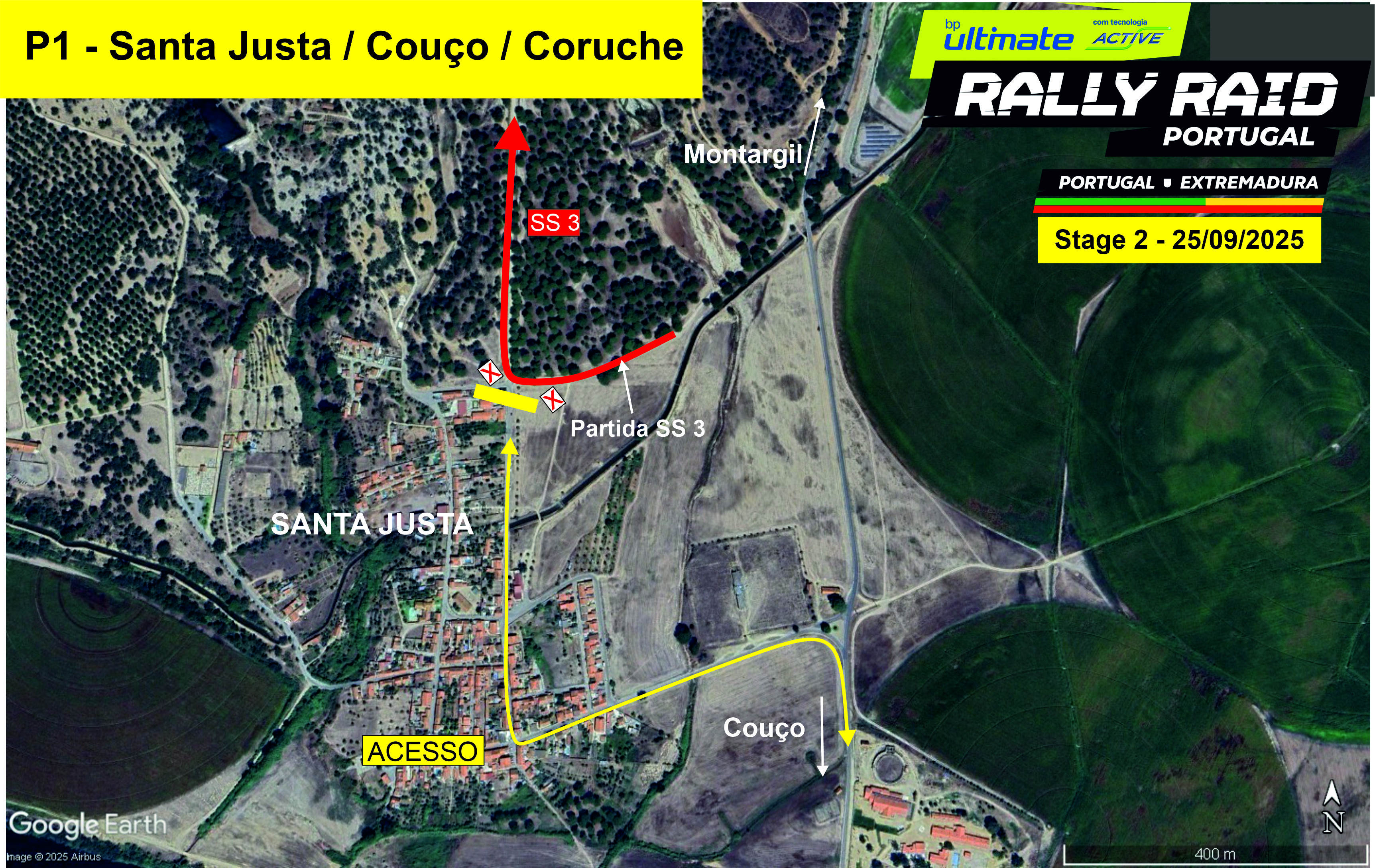
Location: Near Santa Justa, Couço - 200m after start
Features: Immediately after SS start, 90.º entry into dirt track
How to get there: Google Maps
Access: From Couço towards Santa Justa
Schedule:
1st Bike at 7h30am
1st Car at 9h30am
P2 - Foros do Arrão / Ponte de Sor
39° 8.829'N - 8° 15.844'W
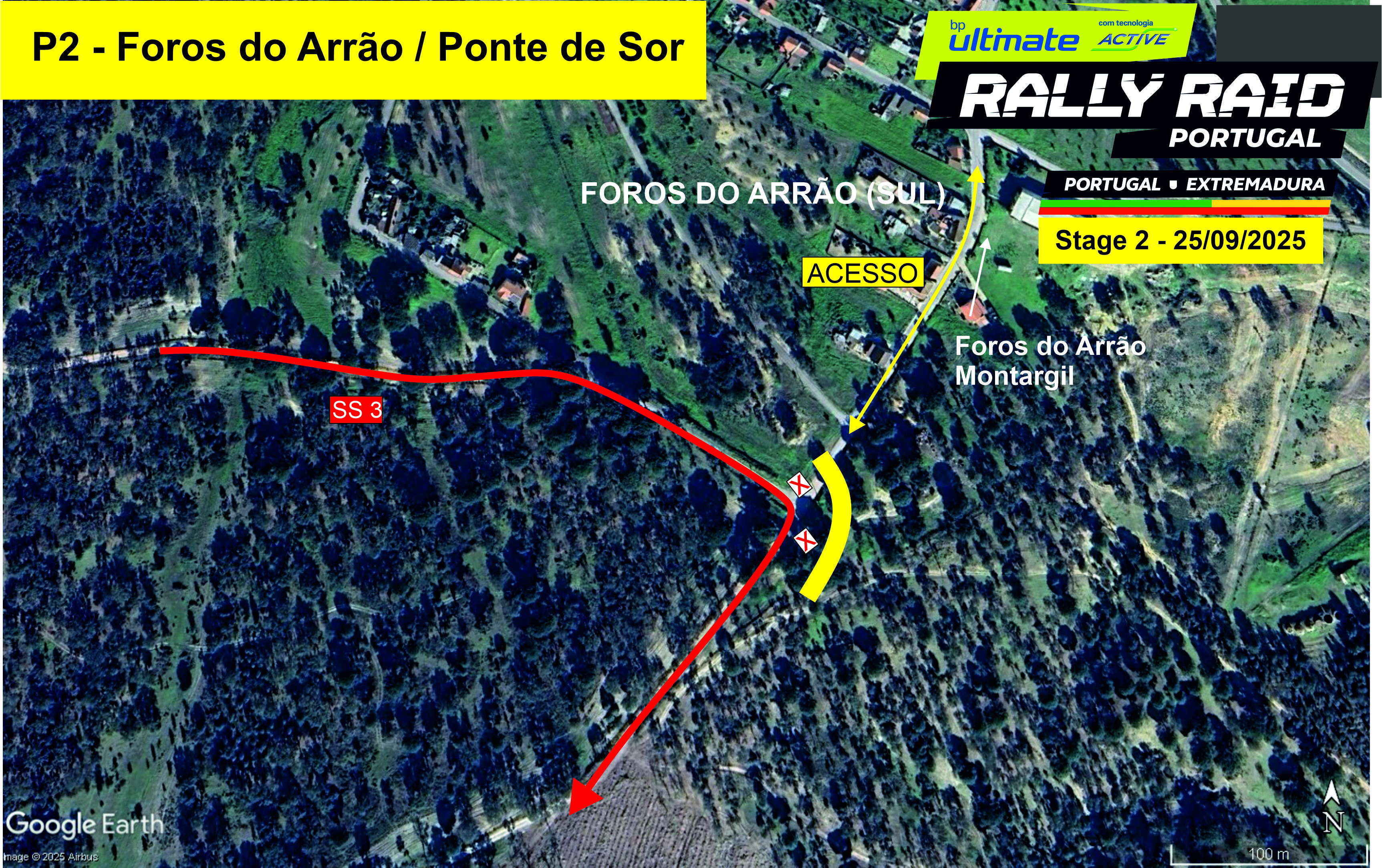
Location: Near Foros do Arrão - km 24
Features: Transition from dirt to asphalt and back to dirt
How to get there: Google Maps
Access: From Foros do Arrão (south), via EN243 Montargil / Foros
Schedule:
1st Bike at 7h50am
1st Car at 9h50am
P3 - Domingão / Ponte de Sor
39° 15.201'N - 8° 2.343'W
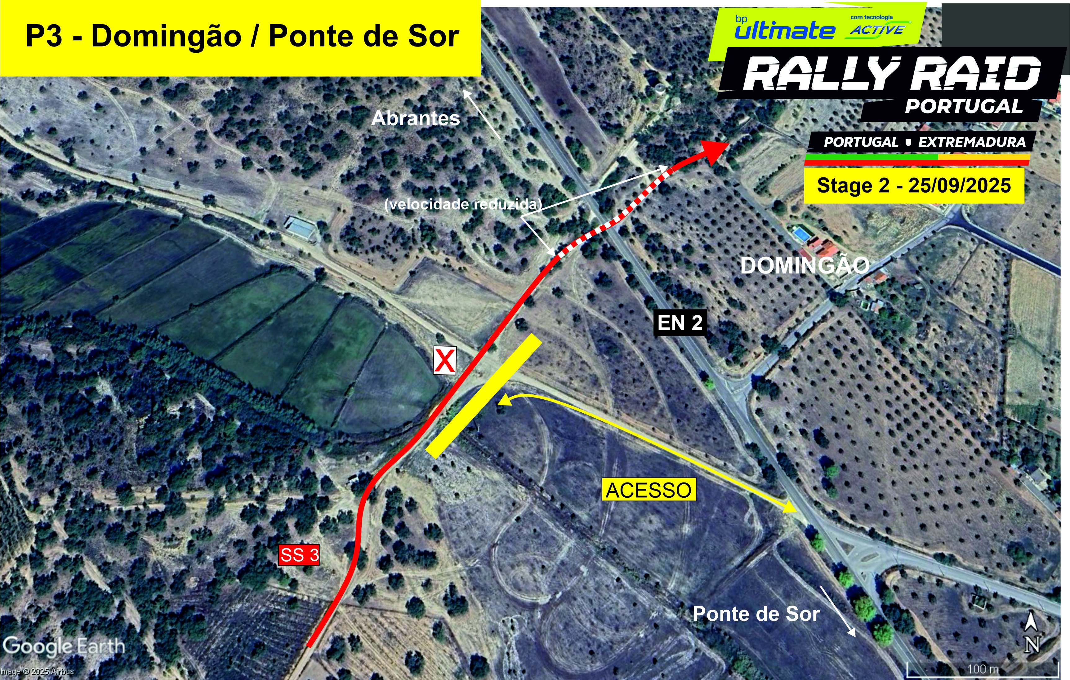
Location: Near Domingão - km 58
Features: Stream crossing
How to get there: Google Maps
Access: From Ponte de Sor, near EN2
Schedule:
1st Bike at 8h15am
1st Car at 10h15am
P4 - Pego / Abrantes
39° 27.663'N - 8° 6.753'W
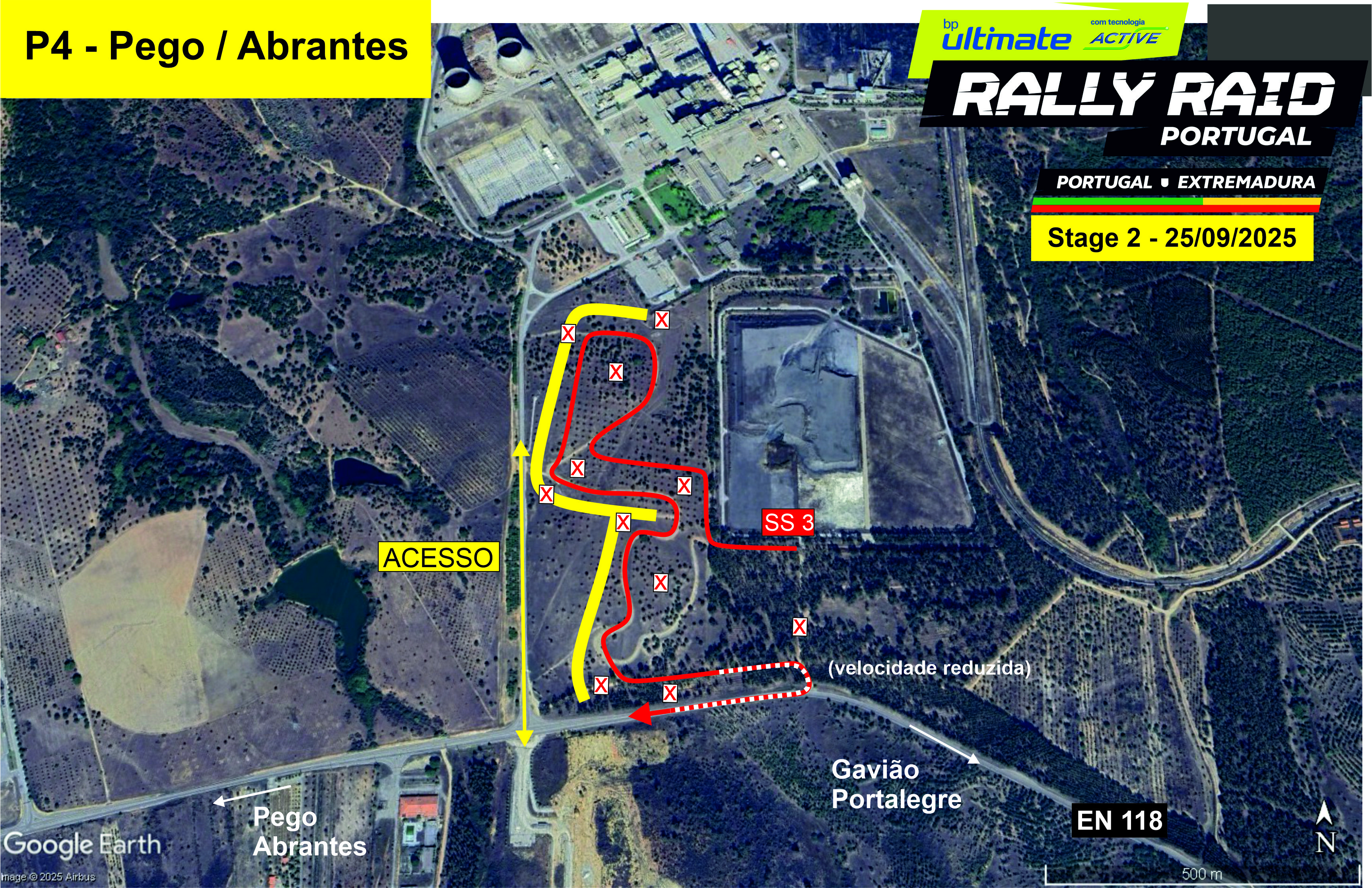
Location: Pego Thermal Power Plant, near EN118 - km 103
Features: Artificial stage with excellent visibility. Coincides with Car start for SS4
How to get there: Google Maps
Access: Near Pego, easy access from A23 and Abrantes.
Schedule:
1st Bike at 8h50am
1st Car at 10h50am
P5 - Mação
39º 32. 465N - 8º 0. 460W
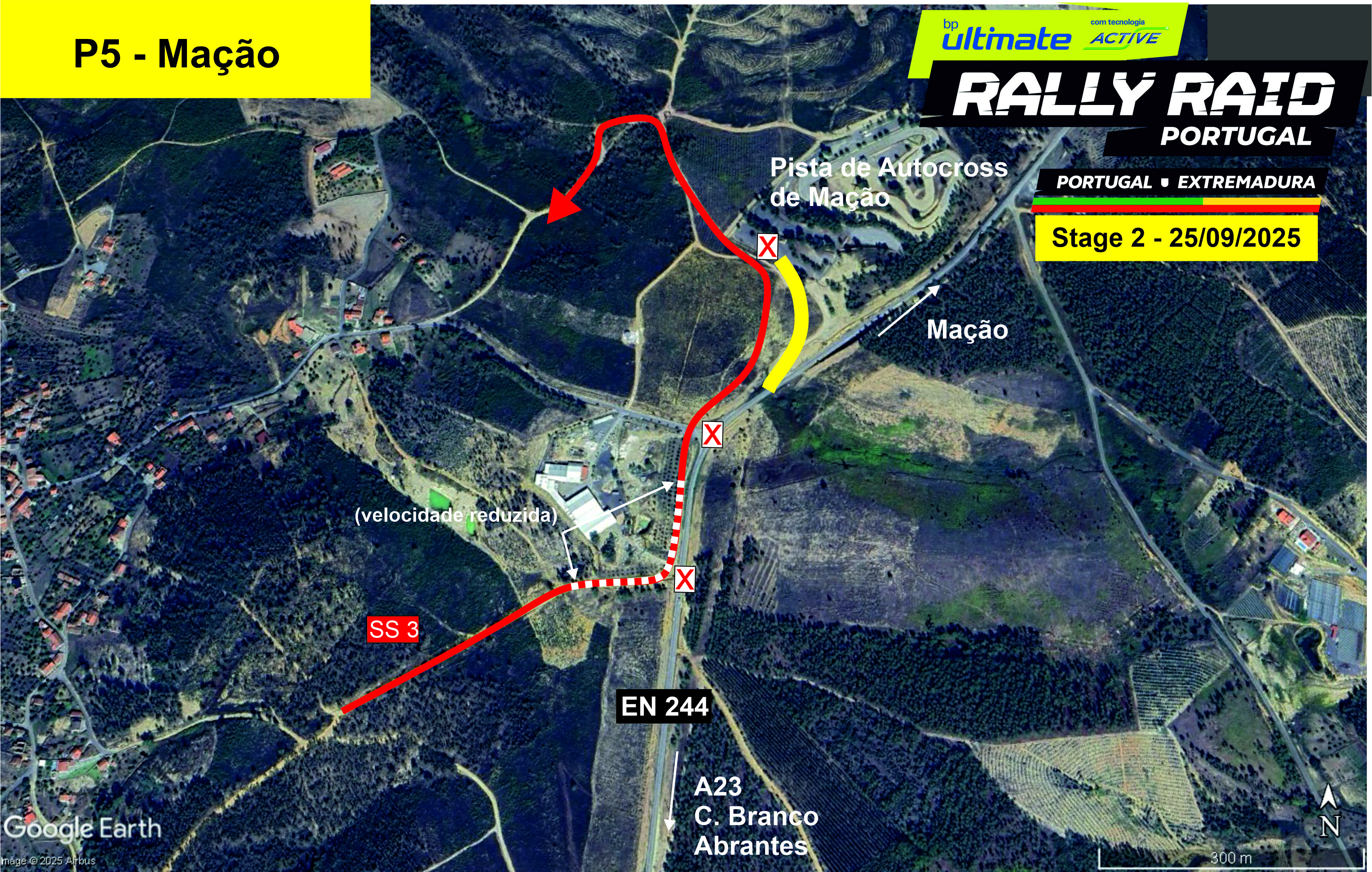
Location: Near Mação autocross track - km 142
Features: Good visibility in a technical section
How to get there: Google Maps
Access: From Mação or A23.
Schedule:
1st Bike at 10h00am
1st Car at 12h00pm
P6 - Arganil / Mação
39° 40.278'N - 7° 58.328'W
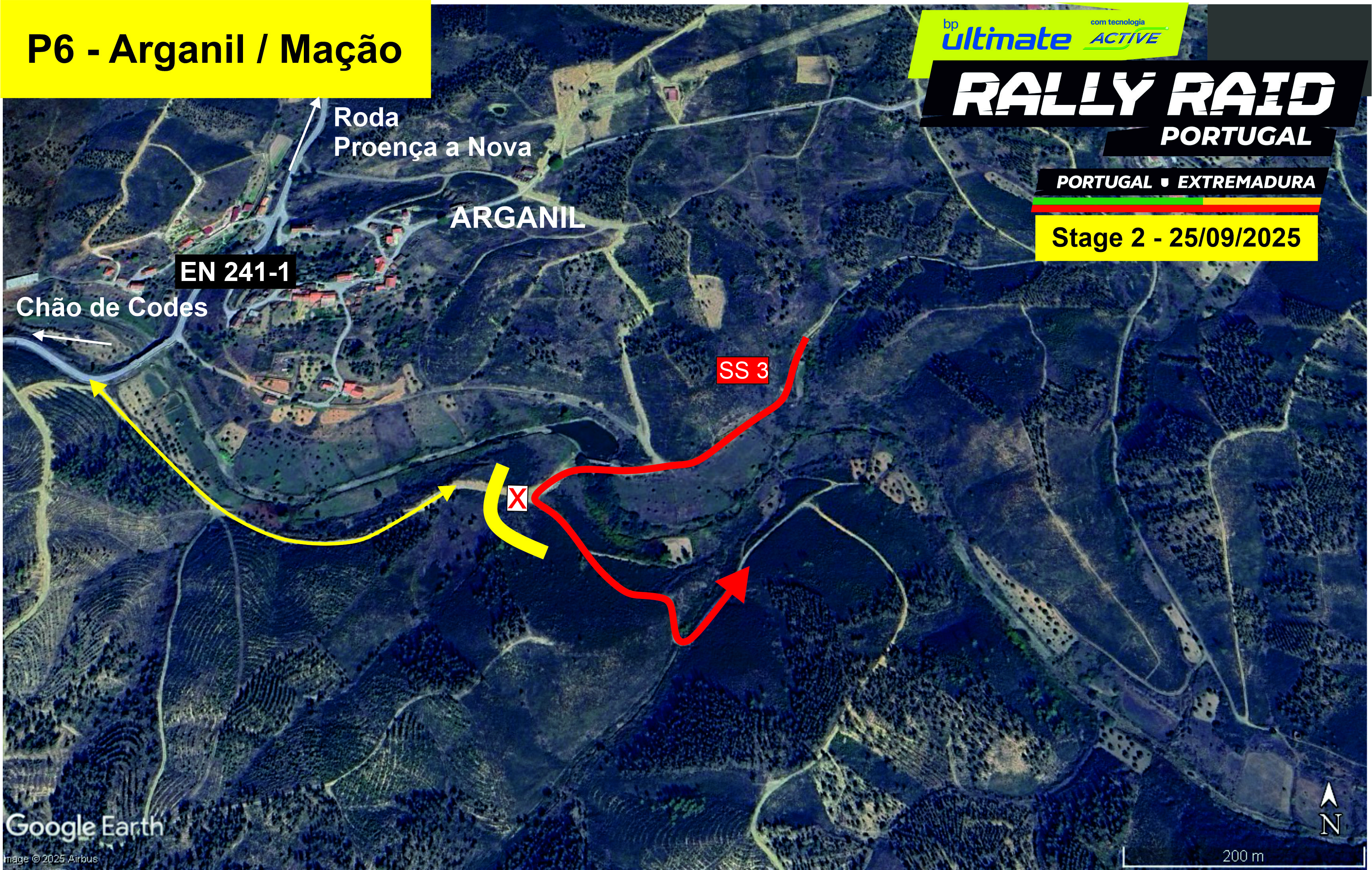
Location: Near Arganil - km 182
Features: Good visibility with several corners
How to get there: Google Maps
Access: Via EN241-1 (Proença / Mação)
Schedule:
1st Bike at 10h30am
1st Car at 12h30pm
P7 - Mação (Zona Industrial)
39º 32. 465N - 8º 0. 460W
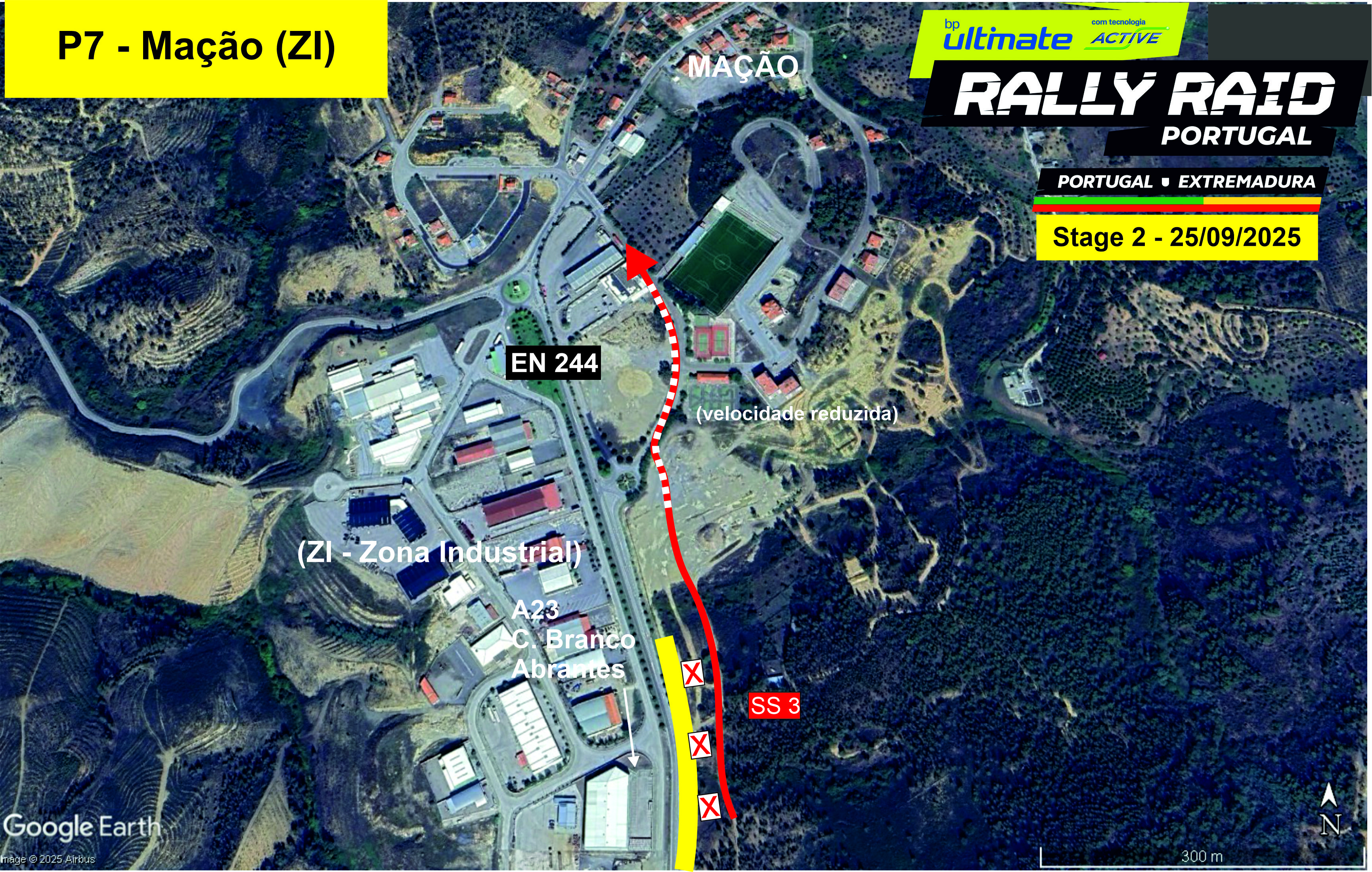
Location: In front of Mação Industrial Zone - km 220
Features: Competitors pass by asphalt before heading to the liaison section towards Spain
How to get there: Google Maps
Access: From Mação or A23.
Schedule:
1st Bike at 11am
1st Car at 1pm
P8 - San Vicente de Alcantará (Spain)
39º 21. 756N - 7º 7. 230O
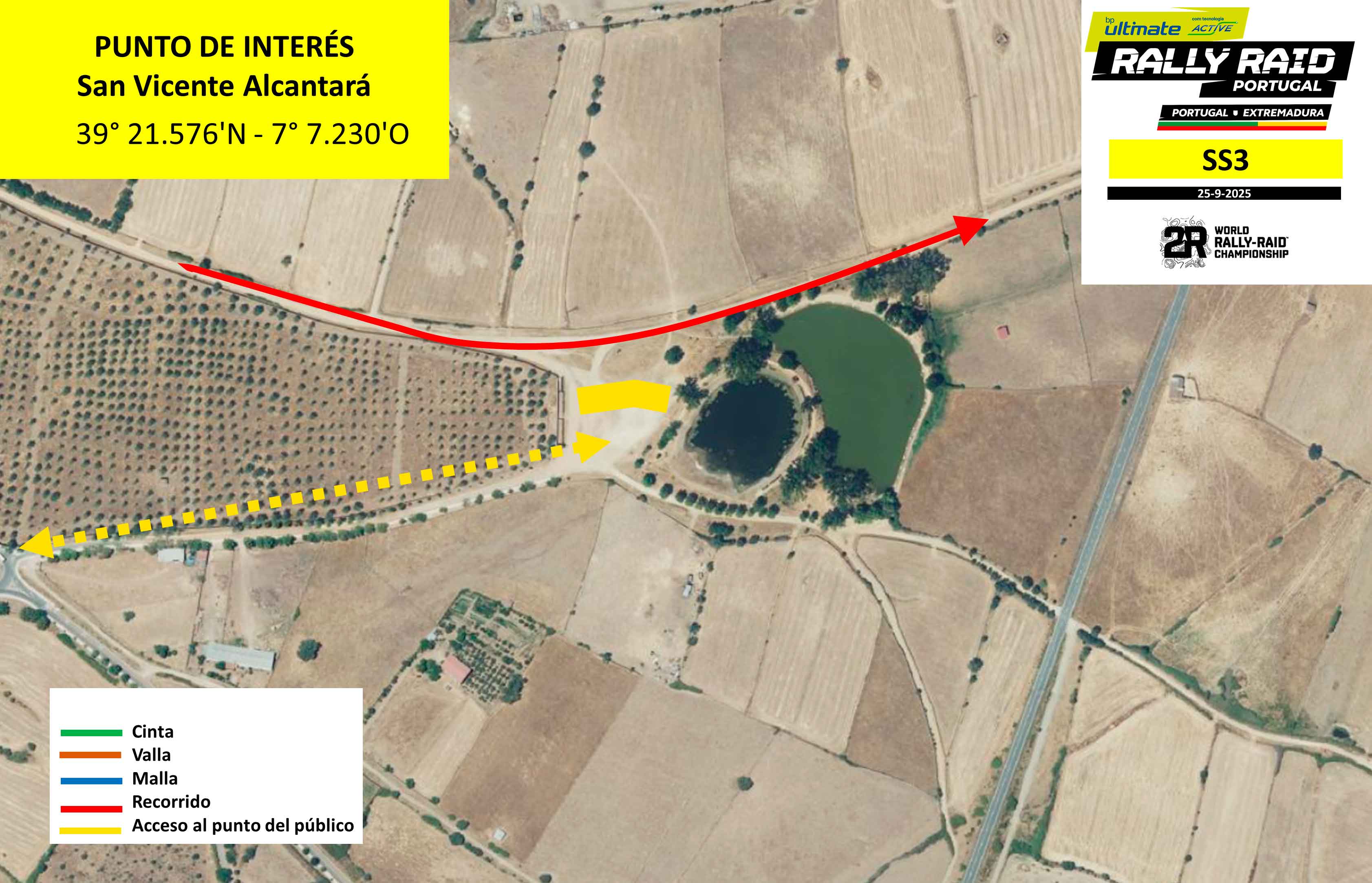
Location: San Vicente Alcantará, Ejido de las Charcas - km 332
Features: Vehicles pass by a park and lake, fast section
How to get there: Google Maps
Access: From Ermida de San Cristobal roundabout in San Vicente de Alcántara
Schedule:
1st Bike at 12h40pm (Portuguese Hour)
1st Car at 2h40pm (Portuguese Hour)
P9 - Arroyo de la Luz (Spain)
39º 29. 067N - 6º 34. 298O
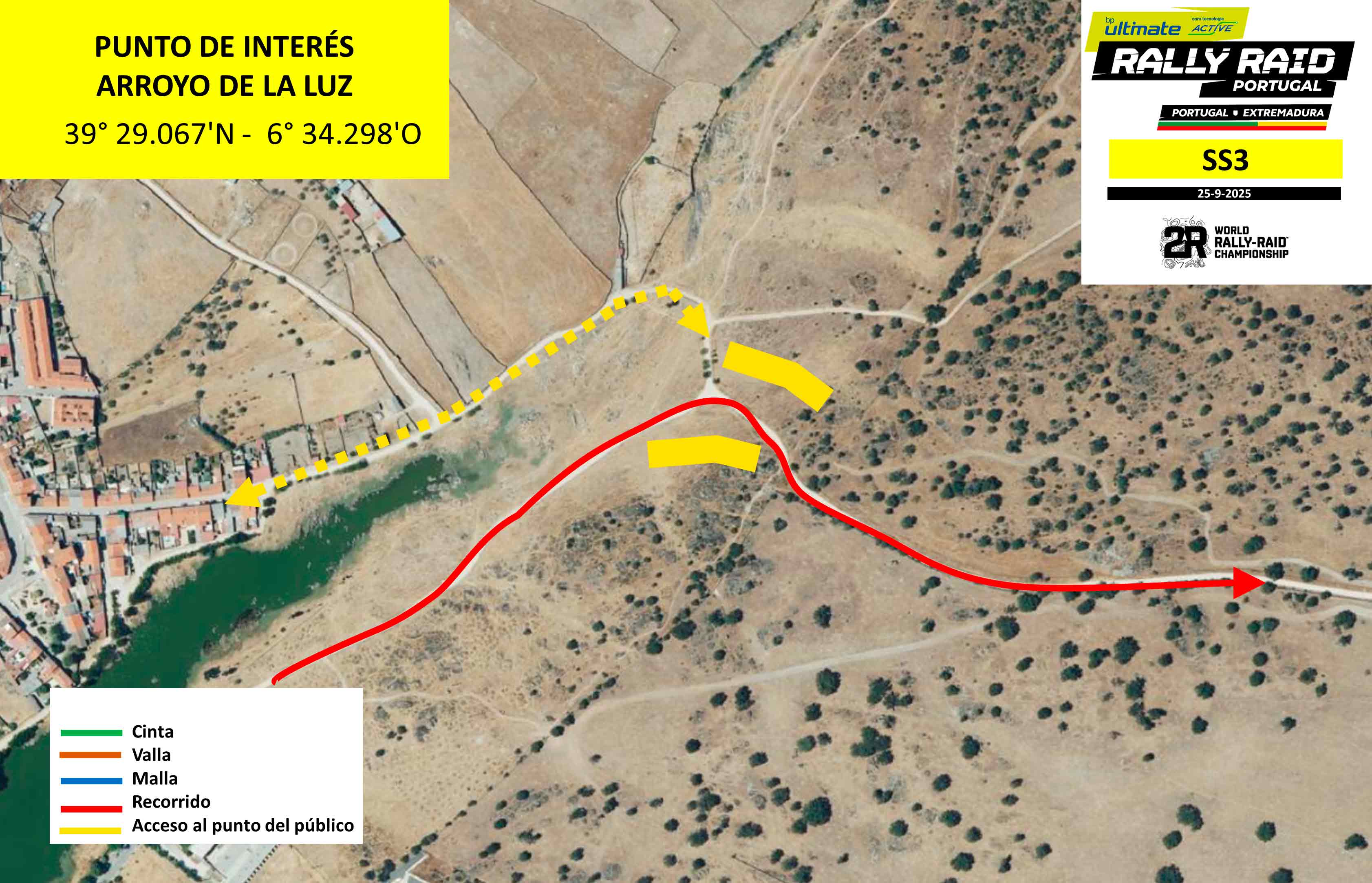
Location: Near Charca del Pozo - km 412
Features: Series of linked corners near village of Arroyo de la Luz
How to get there: Google Maps
Access: Calle Dueñas, Arroyo de la Luz.
Schedule:
1st Bike at 1h35pm (Portuguese Hour)
1st Car at 3h35pm (Portuguese Hour)
P10 - Cáceres (Spain)
39º 28. 430N - 6º 24. 116W
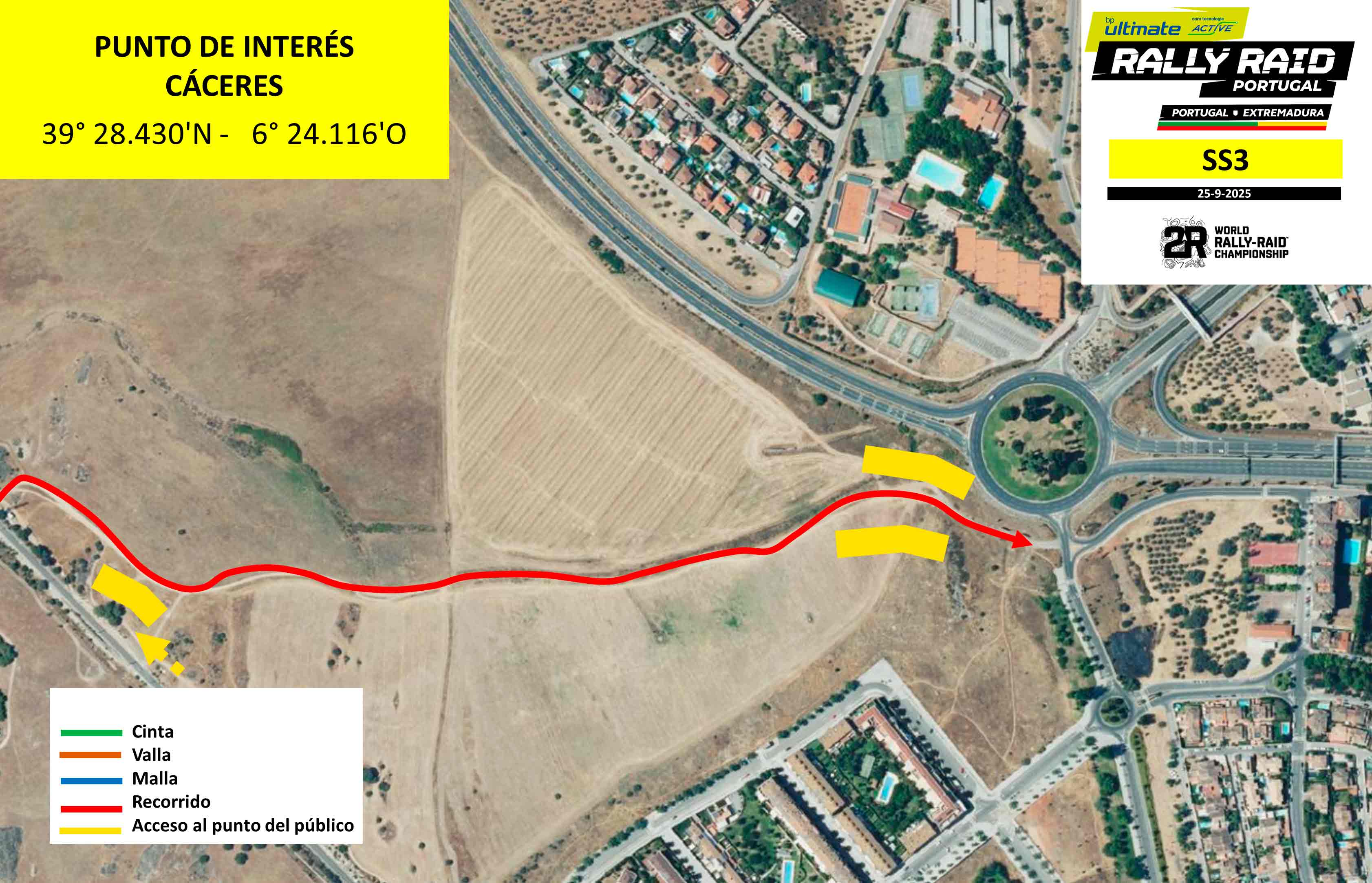
Location: Near Glorieta V Centenario in Cáceres- km 429
Features: Stage finish with series of linked corners
How to get there: Google Maps
Access: Glorieta V Centenario, parking nearby in a residential area
Schedule:
1st Bike at 1h50pm (Portuguese Hour)
1st Car at 3h50pm (Portuguese Hour)