Stage 1 (24/09) - Grândola / Grândola
SS1 / SS2
P1 - S. Matias / Beja
38° 6.367'N - 7° 50.774'W
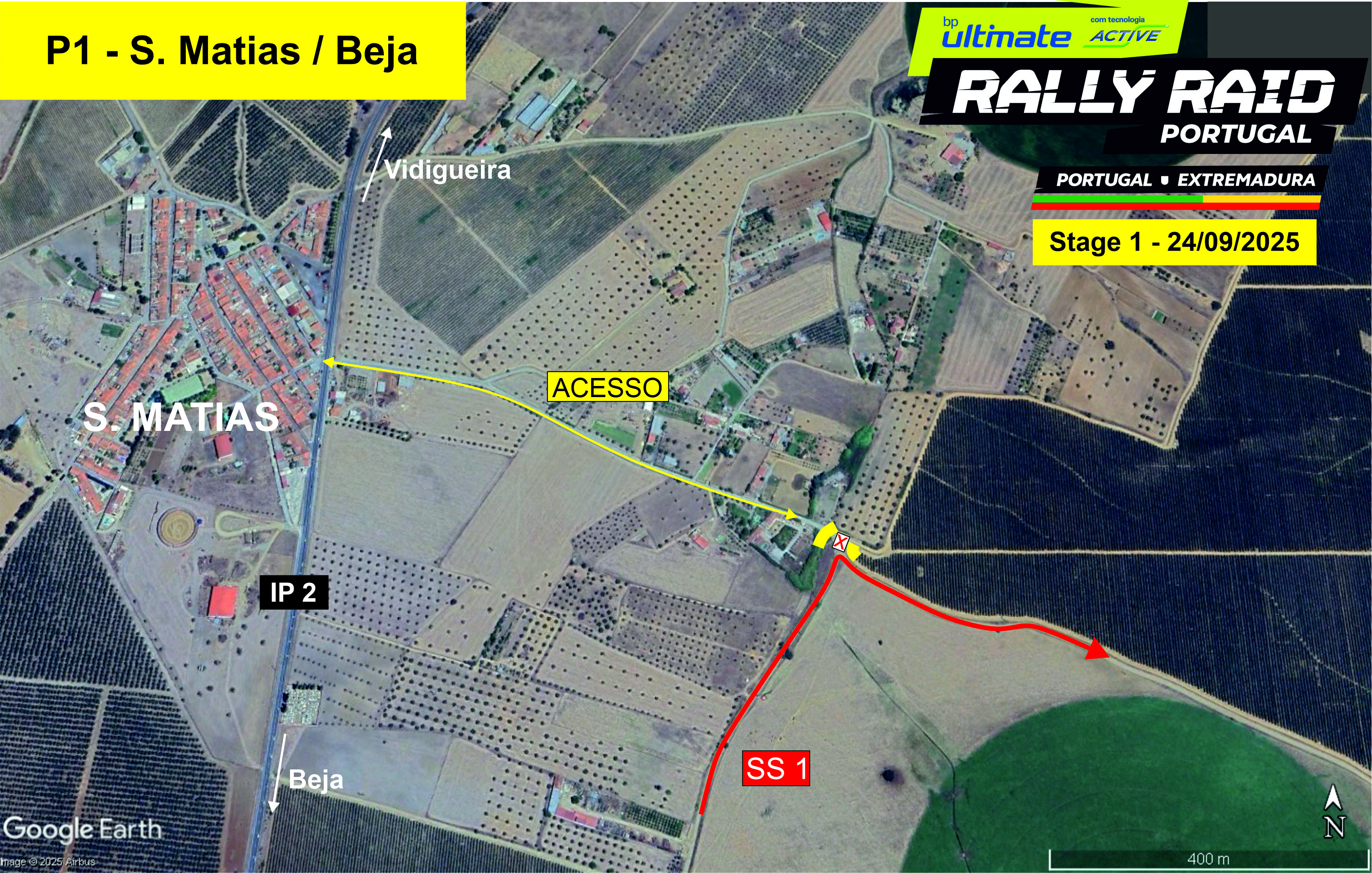
Location: S. Matias, near the village – km 7
Features: 90º corner
How to get there: Google Maps
Access: IP2 (S. Matias)
Schedule:
1st Bike at 8h10am
1st Car at 10h10am
P2 - Baleisão / Beja
38° 2.310'N - 7° 41.978'W
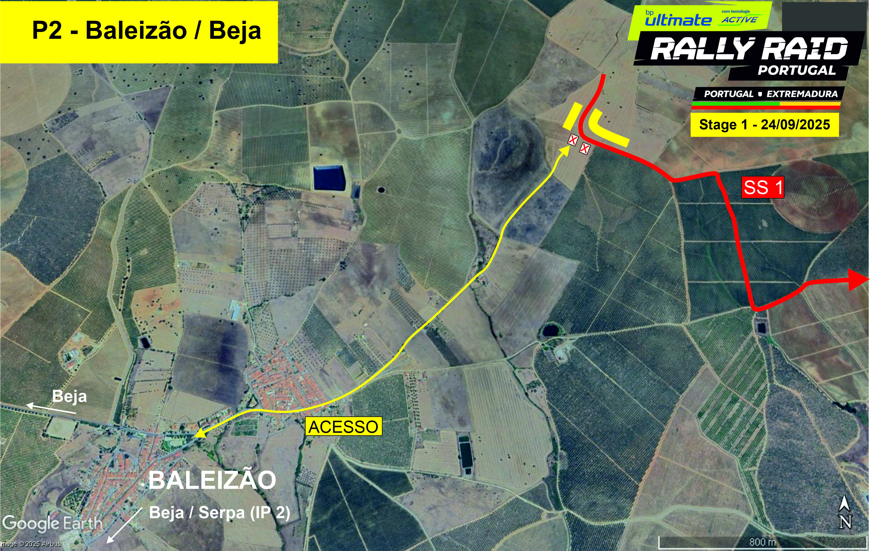
Location: Baleizão - km 32
Features: 90.º left after a crest, good visibility
How to get there: Google Maps
Access: From IP2 (Beja / Serpa)
Schedule:
1st Bike at 8h30am
1st Car at 10h30am
P3 - Vale Russins / Beja
37° 52.440'N - 7° 45.116'W
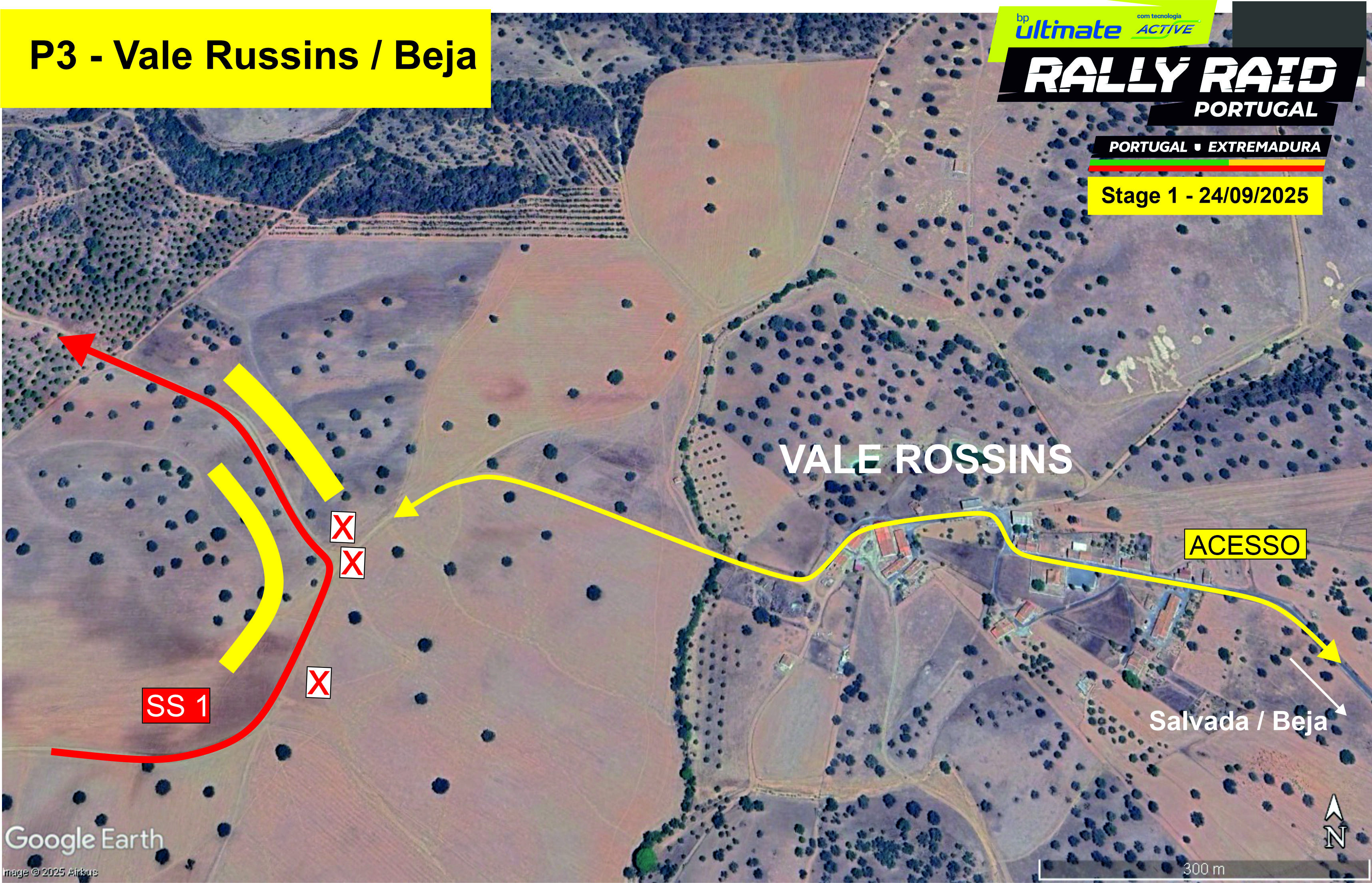
Location: Near Vale Russins village – km 82
Features: Excellent visibility, twisty, good fast surface
How to get there: Google Maps
Access: From Beja via Salvada
Schedule:
1st Bike at 9h05am
1st Car at 11h05am
P4 - Cabeça Gorda / Beja
37° 55.084'N - 7° 46.844'W
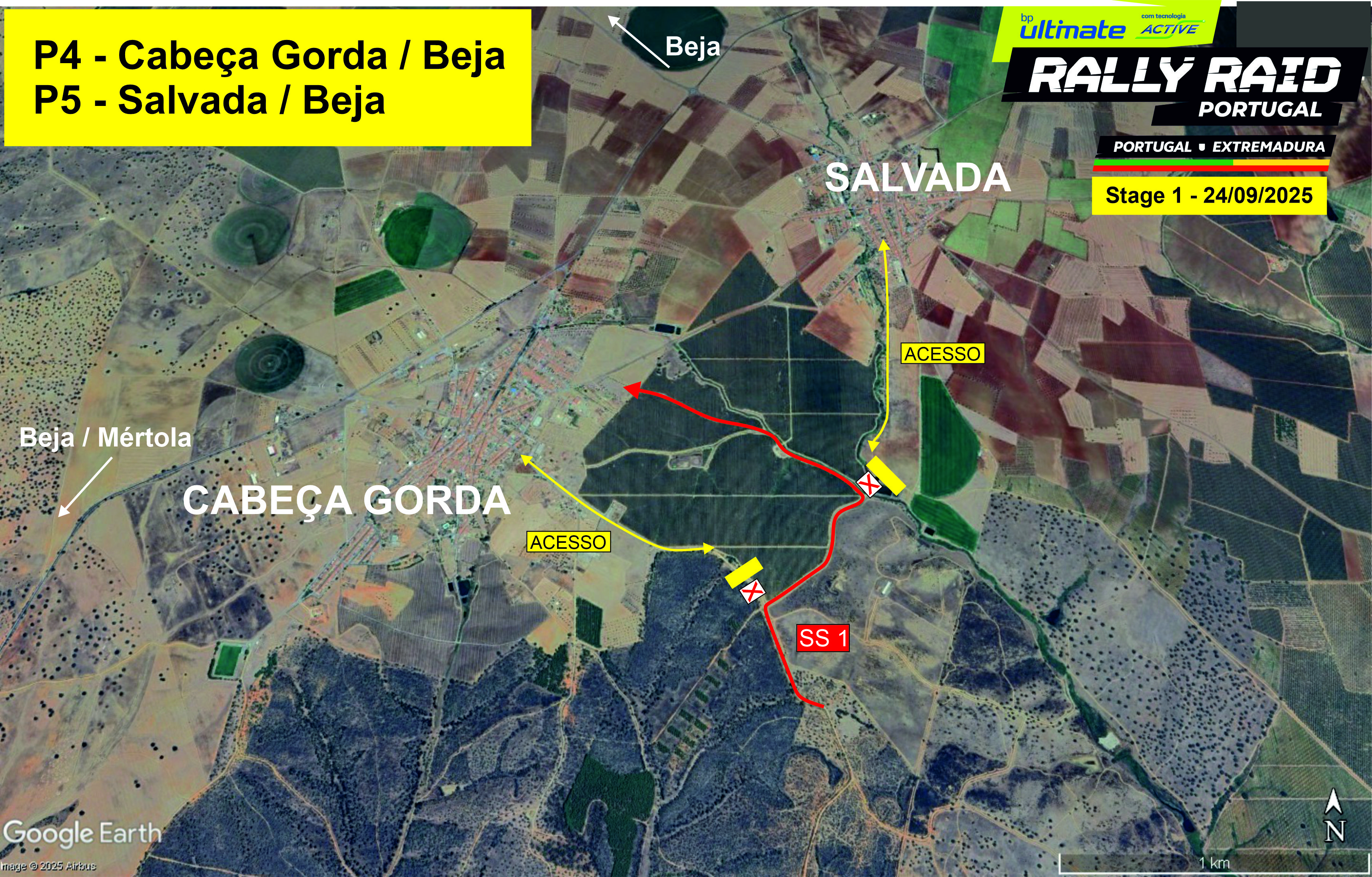
Location: Near Cabeça Gorda - km 89
Features: Good visibility in a fast section
How to get there: Google Maps
Access: Cabeça Gorda, road by the football field
Schedule:
1st Bike at 9h10am
1st Car at 11h10am
P5 - Salvada / Beja
37° 55.342'N - 7° 46.589'W
Location: Near Salvada - km 90
Features: 90.º junction
How to get there: Google Maps
Access: Via Salvada
Schedule:
1st Bike at 9h10am
1st Car at 11h10am
P6 - Trindade / Beja
37° 52.976'N - 7° 53.729'W
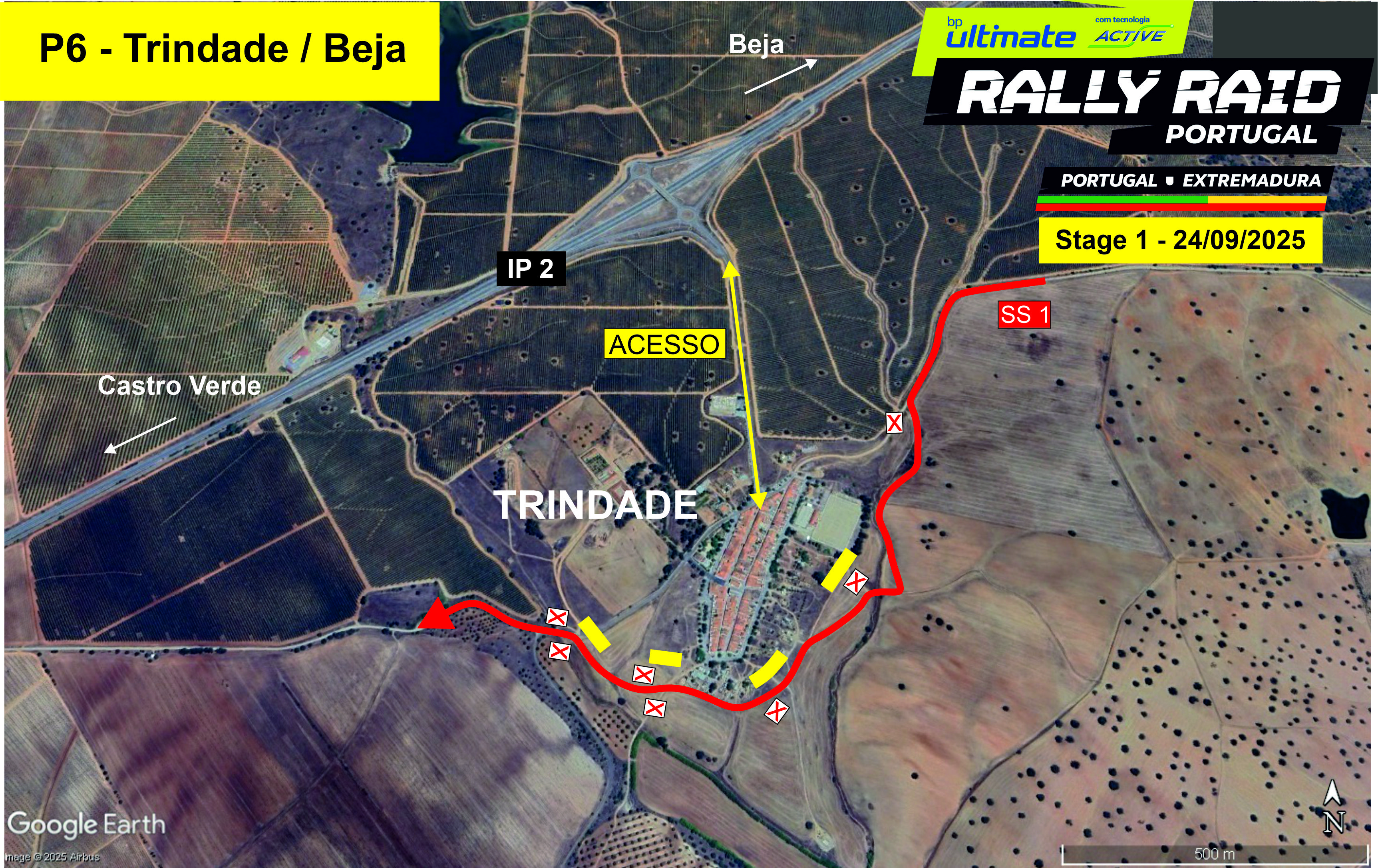
Location: Near Trindade - km 115
Features: Good visibility in various spots
How to get there: Google Maps
Access: IP2 Trindade
Schedule:
1st Bike at 9h35am
1st Car at 11h35am
P7 - Albernoa / Beja
37° 51.447'N - 7° 57.394'W / 37° 51.845'N - 7° 57.615'W
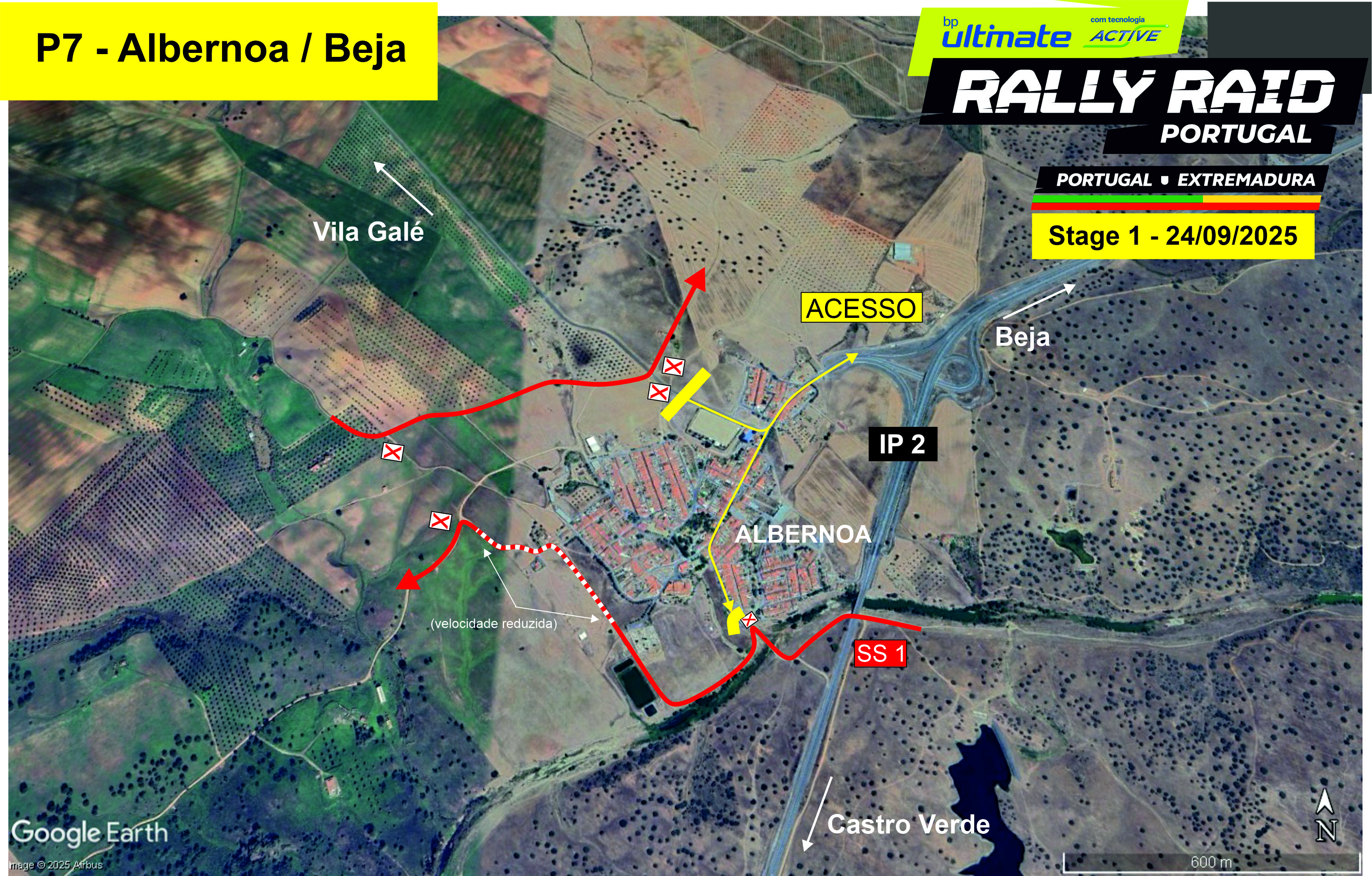
Location: Near Albernoa - km 124 e km 144
Features: Two spots: first by the old bridge (technical, good visibility); second at asphalt crossing towards Vila Galé de Albernoa, fast with good visibility
How to get there: Google Maps
Access: IP2 Albernoa
Schedule:
1st Bike at 9h45am / then at 9h55am
1st Car at 11h45am / then at 11h55am
P8 - S. Clara do Louredo / Beja
37° 57.487'N - 7° 53.747'W
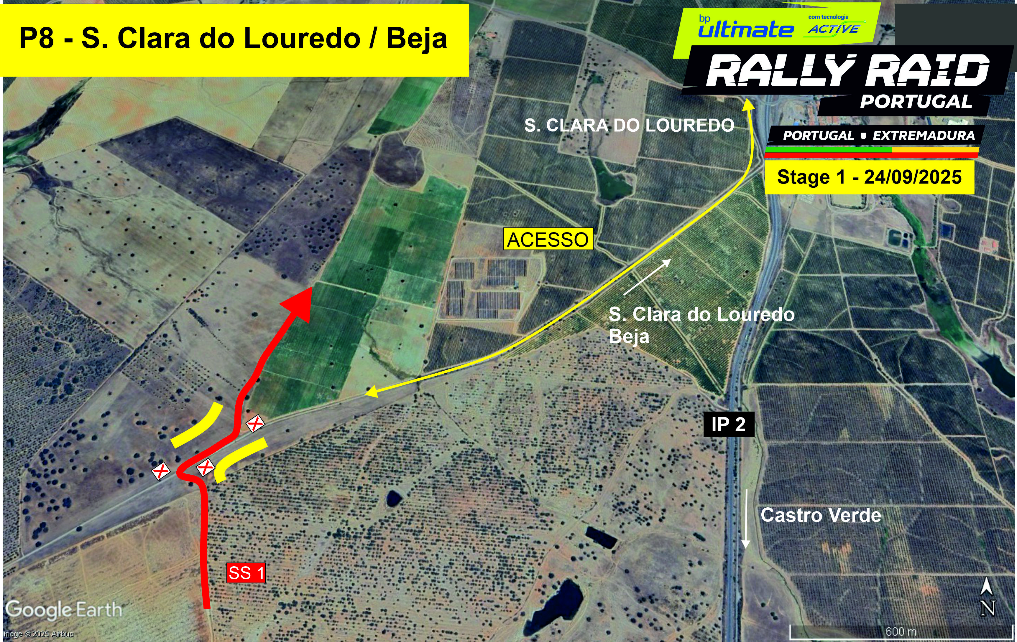
Location: Near S. Clara do Louredo, IP2 - km 160
Feattures: Twisty but fast and with good visibility
How to get there: Google Maps
Access: From S. Clara roundabout towards Penedo Gordo, dirt road parallel to IP2 (3 km in good condition)
Schedule:
1st Bike at 10h05am
1st Car at 12h05pm
P9 - Alvalade / Santiago do Cacém
37° 56.787'N - 8° 24.251'W
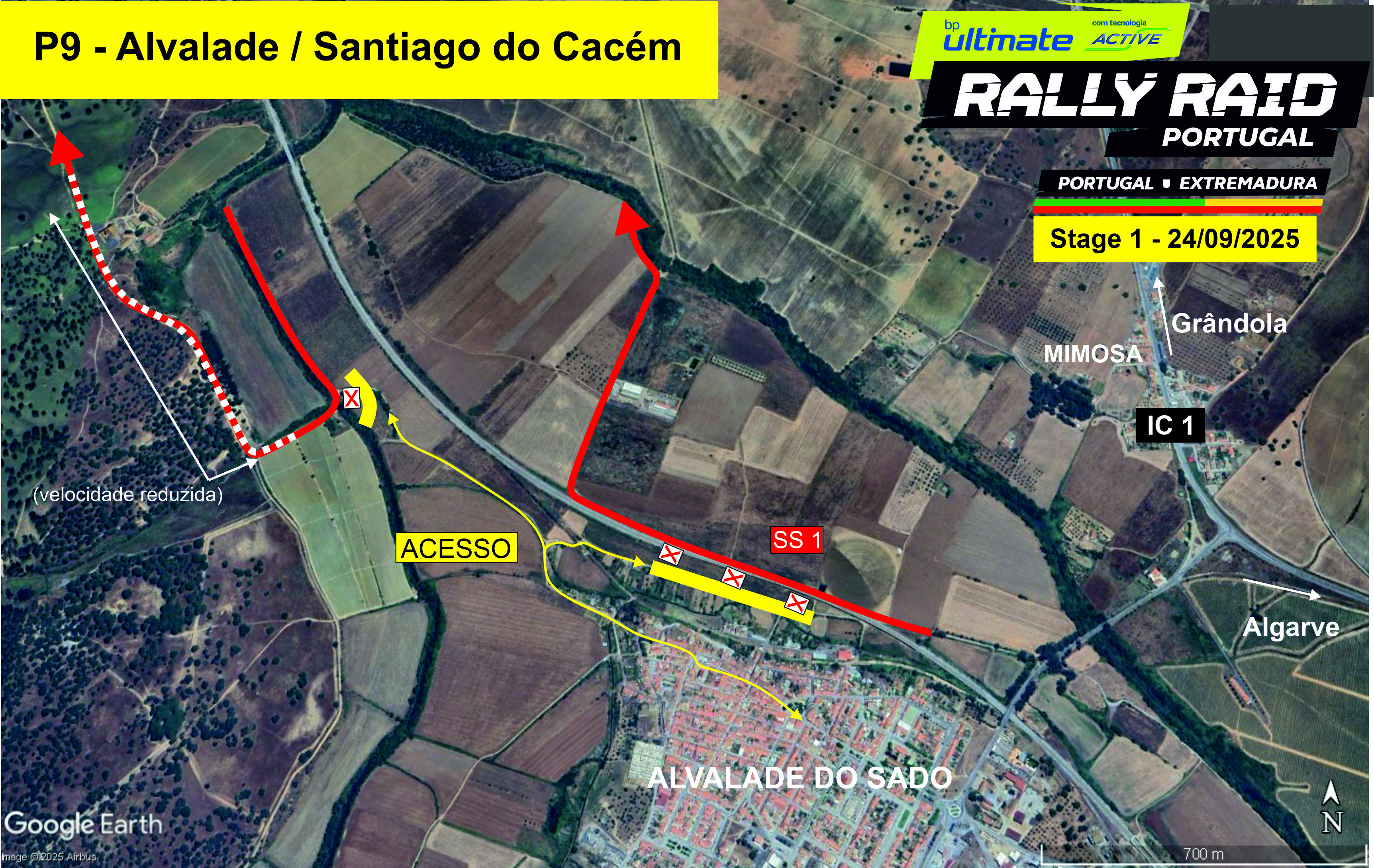
Location: Near Alvalade do Sado - km 222
Features: River crossing near medieval bridge, technical with good visibility
How to get there: Google Maps
Access: Alvalade
Schedule:
1st Bike at 12h05pm
1st Car at 2h05pm
P10 - Ermidas / Santiago do Cacém
37° 59.964'N - 8° 25.395'W
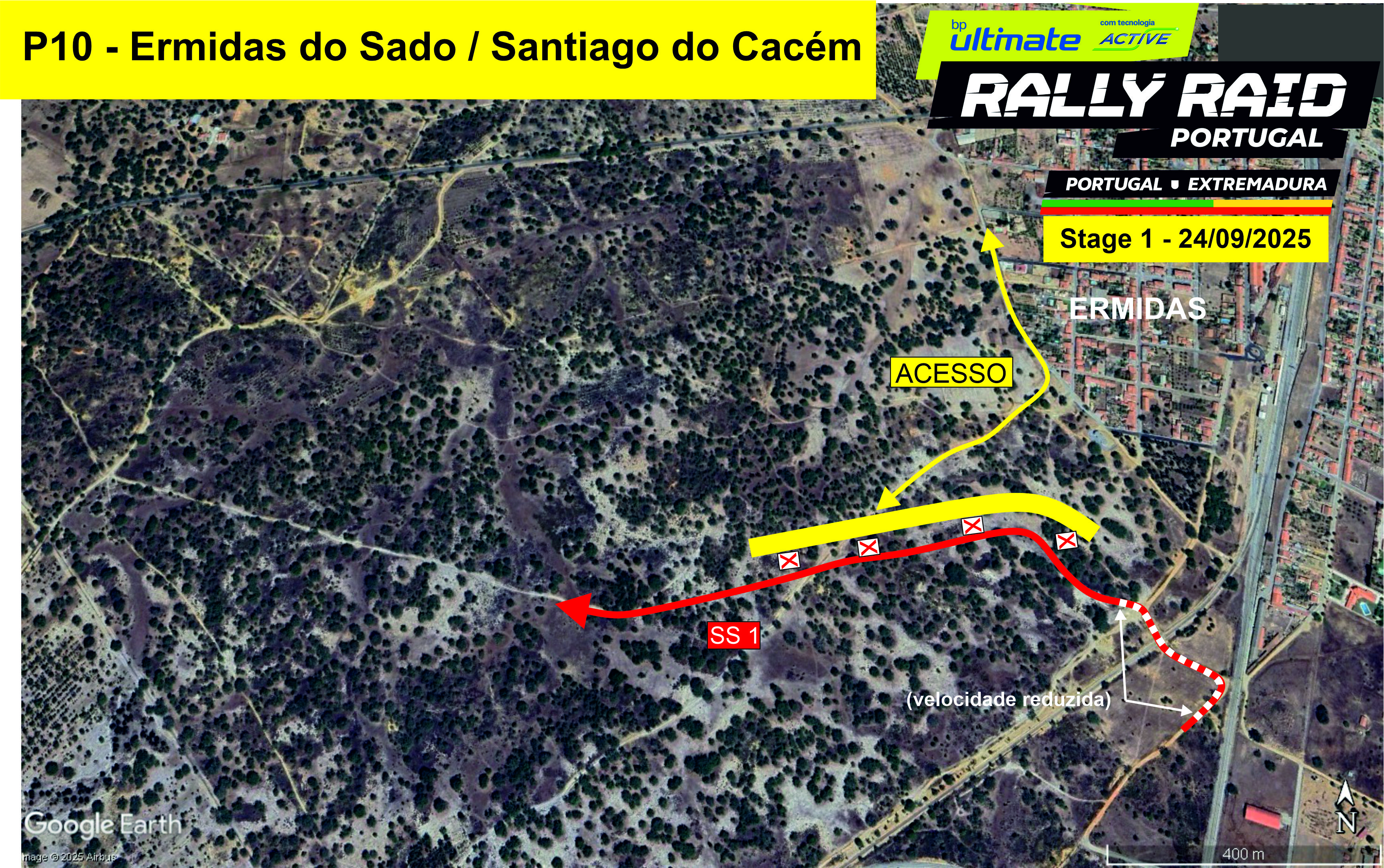
Location: Near Ermidas do Sado - km 230
Featues: Fast with a sandy surface and good visibility
How to get there: Google Maps
Access: Via Ermidas
Schedule:
1st Bike at 12h10pm
1st Car at 2h10pm
P11 - Azinheira dos Barros / Grândola
38° 4.519'N - 8° 25.463'W
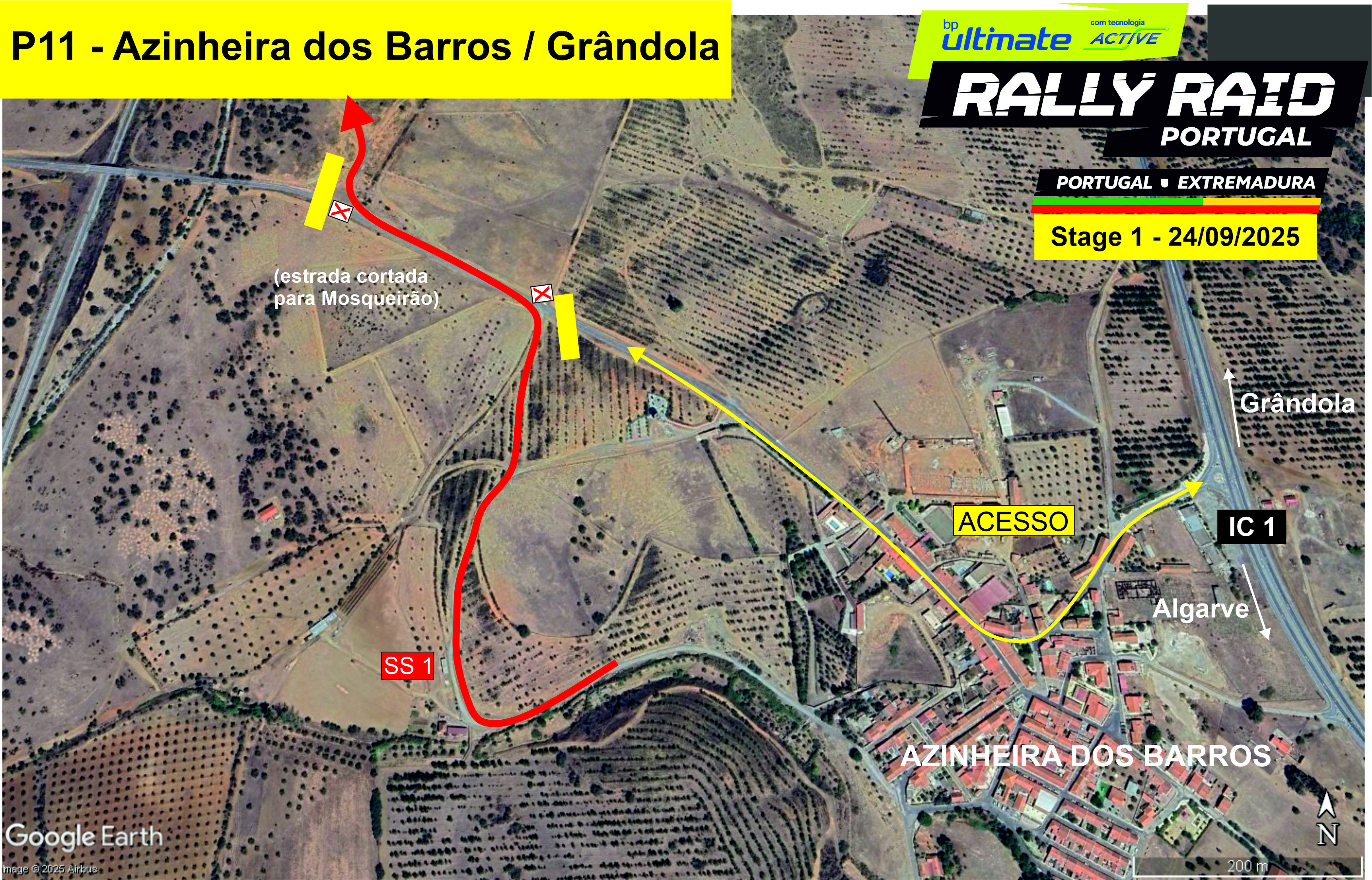
Location: Near Azinheira dos Barros - km 244
Features: Entry and exit from asphalt with good visibility
How to get there: Google Maps
Access: From IC1 and Azinheira dos Barros (road between Azinheira and Mosqueirões closed to traffic)
Schedule:
1st Bike at 12h20pm
1st Car at 2h20pm
P12 - Grândola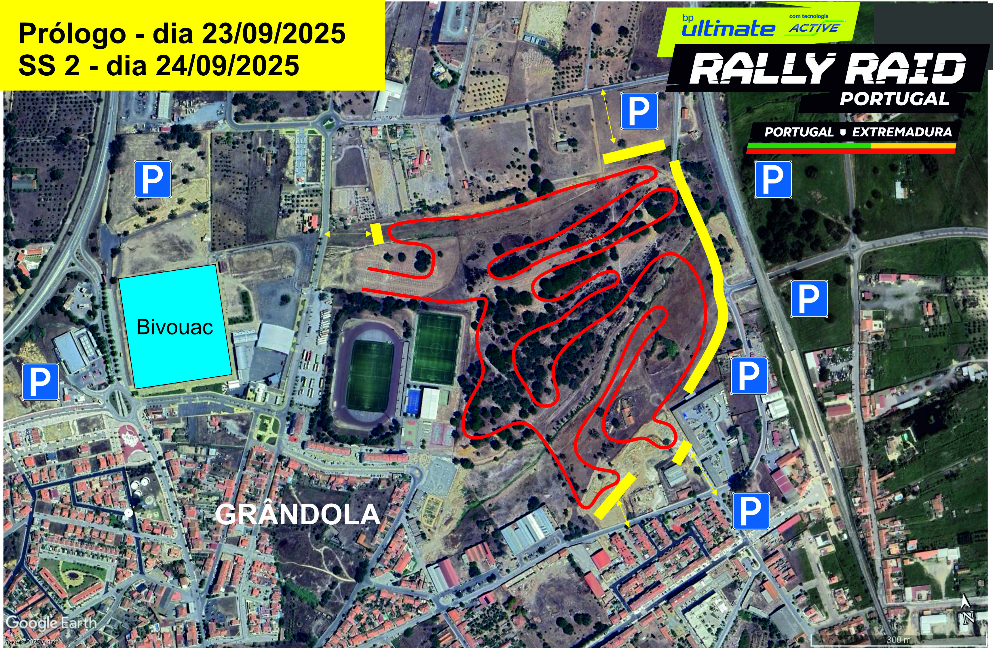
Location: Grândola, same place as Prologue
Features: Artificial stage with 4 spectator zones, good visibility
How to get there: Google Maps
Access: Grândola (follow signage, parking areas)
Schedule:
1st Bike at 3pm
1st Car at 5pm